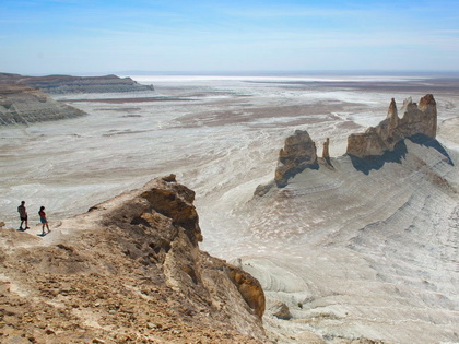
Dzhungariya, Kazakhstan

Dzungar Alatau is a mountain system, which occupies 700 sq. km, and is situated at the border of two big mountain systems Eastern Tien Shan and Altai. Dzungar Alatau is divided in two parts: region of the Lepsy river, and region of the Usek river. The highest summit is peak of Semenov-Tienshanski located at the Kazakhstan-Chinese border at the altitude of 4.622 m above sea level. Not far from the border there is a mountain pass with a width of 10 to 50 km called Dzhungarski Gate. Semi desert, which turns into steppe stretchs up to the altitudes of 2.600 m, above which there are Alpine meadows. A narrow ridge of Dzhungar Alatau with sharp peaks and steep slopes has lots of rocky precipices with a height of 400-1000 m. Above the altitude of 3.500 m the ridge is covered with eternal snow and glaciers. Mountain valleys are narrow and up to 800-1.000 m deep, most mountains are difficult to access.
The climate is temperate continental. Winter day temperature is -5-6°C, night one is -15-25°C. Summer day temperature is +20+25°C, night temperature is +5+7°C. The region is sparsely populated. The real masters of this wild region are red wolves, bears, Siberian stags, wild Chalyn rams, and countless rodents. Observant tourists will definitely meet one of these animals.
Trekking is particularly good in the region of Lepsy, Baskan, Aksu lakes, around the mountain lakes Zhasylkol and Bolshoye. Mountains Kokpek, Taurly and Bezymyannyj passes, peak of Semenov-Tienshanski, Volchiy and Banditskiy passes are worth trekking as well.


