Ustyurt Plateau, Uzbekistan
Things to Do and Sightseeing Tours to the Ustyurt Plateau
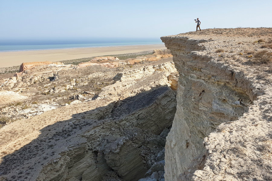
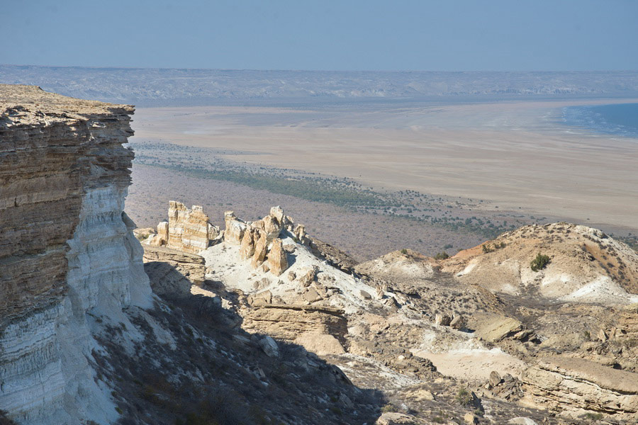
The Ustyurt Plateau is an ancient geological formation spanning over 200,000 square kilometers, located across Uzbekistan, Kazakhstan, and Turkmenistan. This plateau itself is a vast flat semi-desert, but it is uniquely bordered by 100-meter cliffs and walls made of layers of limestone and chalk that have been compressed over millions of years at the bottom of an ancient sea. Today, these cliffs have taken on unusual shapes due to the effects of water, wind, and time.
In Uzbekistan, the Ustyurt Plateau features a long line of cliffs running from north to south, adjacent to the Aral Sea, with the cliffs themselves referred to as "chinks." In Kazakhstan, the plateau includes entire areas with cliffs and even isolated mountains nearby, shaped into complex forms by more intense erosion. The smaller southern portion of the Ustyurt Plateau in Turkmenistan consists of a mix of areas and straight sections of plateau walls, located in a border zone and thus largely inaccessible to tourists.
This guide will focus on the Ustyurt Plateau in Uzbekistan and provide useful links to its sites in Kazakhstan.
Ustyurt Plateau Tours
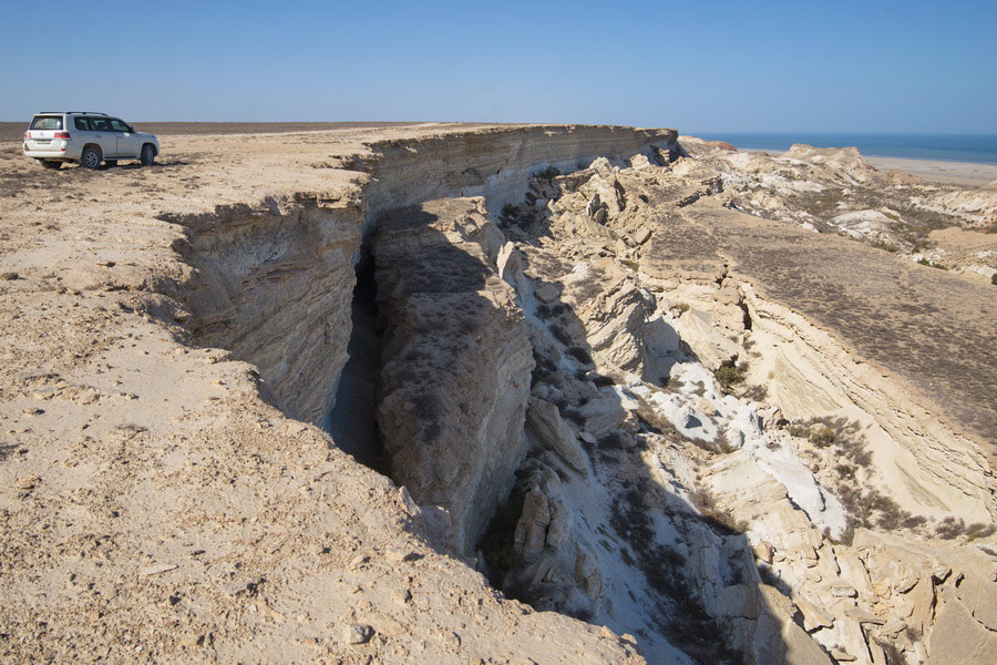
A journey to the Ustyurt Plateau in Uzbekistan typically starts from Nukus, where there's an international airport and where you can find jeeps with drivers familiar with the region. A trip to the plateau is usually part of a tour to the Aral Sea. Departing from Nukus, tourists first visit Muynak and the ship graveyard, then drive across the former seabed to the plateau, and spend the night in a yurt camp on one of its ledges. The return trip can take a slightly different route to see another part of the Ustyurt Plateau – a sharp cape near the abandoned village of Urga, towering over Sudochye Lake.
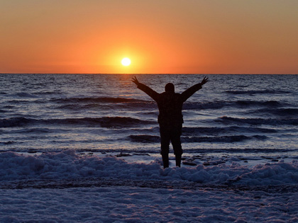
You can visit the Ustyurt Plateau in just one day if you leave Nukus before dawn. However, it's far better to plan a two-day tour to spend the night in a yurt and greet the sunrise over the Aral Sea. Adding another day and some extra cans of gasoline allows for a trip along the plateau to the north, in search of steeper cliffs and rocks.
History of Ustyurt Plateau
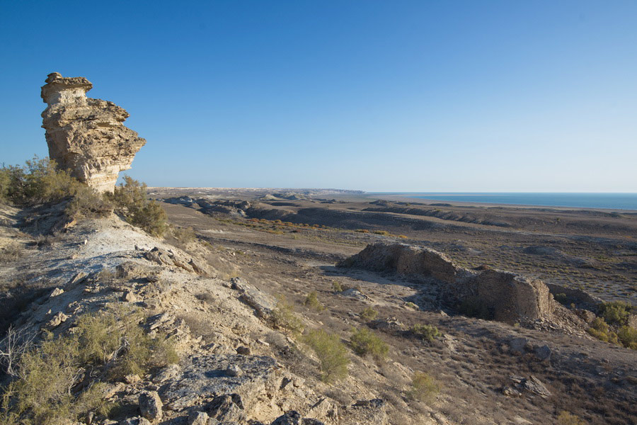
The exact age of the Ustyurt Plateau is unknown, with scientists estimating it to be between 20 and 60 million years old. However, it was definitely part of the ancient Tethys Ocean and later the ancient Sarmatian and Akchagylian seas. Today, prehistoric shark teeth can be found in many parts of Ustyurt, where new cliffs expose the ancient rock.
Throughout human history, the Ustyurt Plateau has been uninhabitable, but as early as the 6th to 3rd millennia BCE, primitive people related to the Kelteminar culture (sedentary fishermen of the Neolithic era) lived near the shores of the Aral Sea. During the heyday of the Great Silk Road, Ustyurt was considered a dangerous, lifeless place – a vast desert without landmarks, springs, or wells for hundreds of kilometers. Caravans usually bypassed the plateau to the south, along the bed of the Uzboy River, or to the north along the Aral Sea. Today, two monuments from those times remain in Uzbekistan – the ruins of the Kurgancha-Kala fortress and the foundation of a lighthouse at Cape Urga.
The first permanent road crossing the Ustyurt Plateau was built in the mid-20th century, and the Kungrad-Beineu railway was laid only in 1972. Although the plateau holds no significant economic value today, its tourism industry is developing, and its most picturesque sites, including the chinks of Ustyurt by the Aral Sea in Uzbekistan and the areas in Mangystau in Kazakhstan, are gaining popularity among tourists.
Attractions of the Ustyurt Plateau
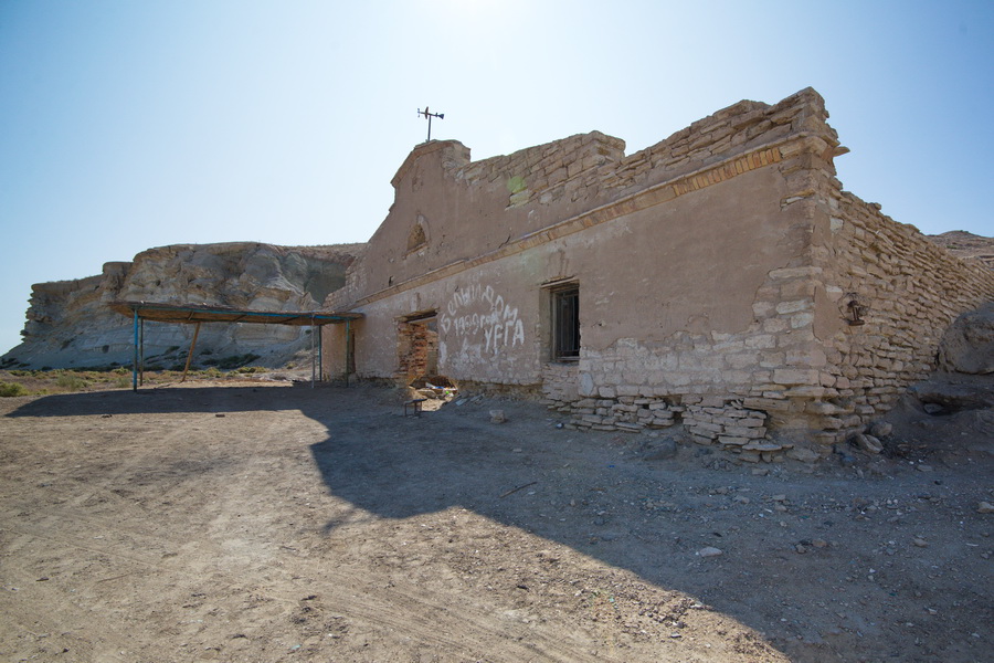
During traditional jeep tours to the Aral Sea, tourists typically visit nearly all the attractions of the Ustyurt Plateau in Uzbekistan:
Kurgancha-Kala – a 13th-century fortress, also known as Karganshikala and Davlet-girey, served as an outpost on the caravan route along the Aral Sea coast. Today, a tourist yurt camp is located nearby.
Kubla-Ustyurt – a settlement built in 1964 along the gas pipeline route. Currently, several hundred people live here, raising camels and selling genuine camel milk.
Urga – a cape with an abandoned settlement and the ruins of a lighthouse above Sudochye Lake. Once home to Russian settlers engaged in fishing, the village gradually fell into disuse and decay, though fishermen still visit today.
Barsakelmes – a salt marsh covering a thousand square kilometers. Today, salt is industrially harvested here. It is located 200 km from the city of Nukus.
Ustyurt in Kazakhstan
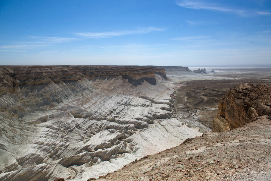
The other end of the Ustyurt Plateau features attractions in the Kazakh part. All are located in the Mangystau region, which, similar to its Uzbek counterpart, is a destination for adventure tourism but encompasses other natural features. Attractions in the Ustyurt Plateau in Kazakhstan include:
Tuzbair – a salt marsh at the very foot of the plateau, where the Ustyurt cliffs are notably white.
Beket-Ata – an 18th-century mosque built by a famous Kazakh Sufi.
Bozzhyra – an area with fantastic viewing platforms over the Ustyurt cliffs.
To travel from the Uzbek part of Ustyurt to the Kazakh part, you have three options, none particularly comfortable:
By Car: Drive directly across the plateau via the Nukus-Beyneu-Aktau route. It's 980 km long, with some rough patches, and will take about 12-15 hours, including the land border crossing.
By Air: Take three flights: Nukus-Tashkent, Tashkent-Almaty, and Almaty-Aktau. This covers a total of 3,600 km and, with good connections, will take nearly a full day.
By Train: Take the Nukus to Aktau (Mangistau) train, which began running in August 2024. It operates three times a week, with a travel time of 21 hours.
How to Get to the Ustyurt Plateau
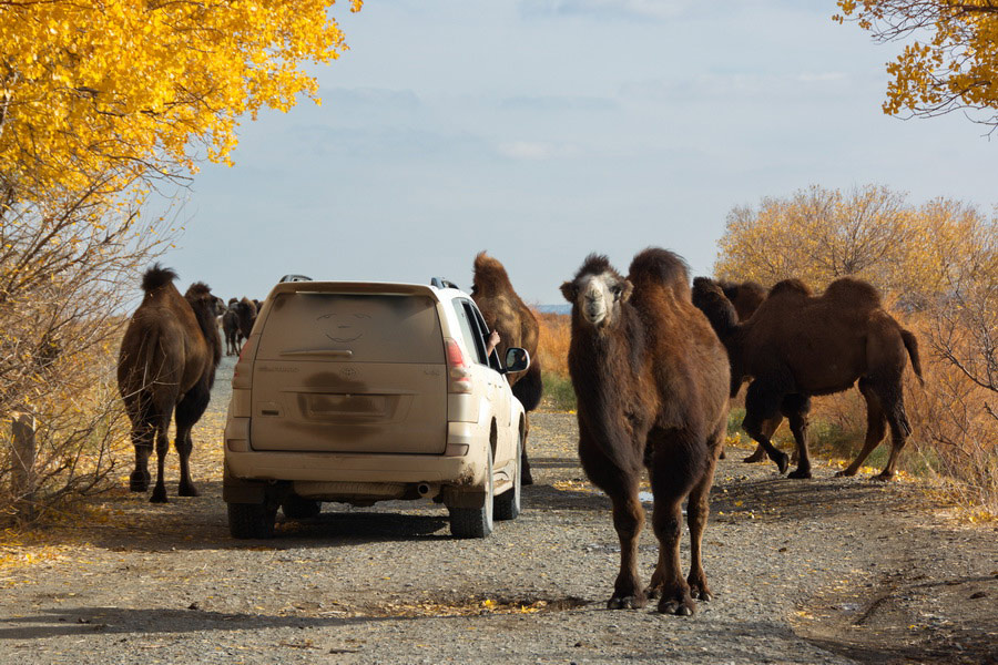
To reach the Ustyurt Plateau, you'll need a jeep. Almost all travelers arrive or fly into the city of Nukus and from there venture to the plateau in an off-road vehicle: first, driving 200 km on good asphalt to the former port of Muynak, then about 80 km on temporary dirt roads across the Aral Sea bed. Then, you can either move north along the plateau from below or find one of the steep climbs to the plateau itself and drive along its ridge, enjoying the panorama.
Nukus, the starting point for tours to Ustyurt, can be reached by car – 190 km from Khiva, by train, or by plane – with daily local flights from Tashkent.
Safety on the Ustyurt Plateau
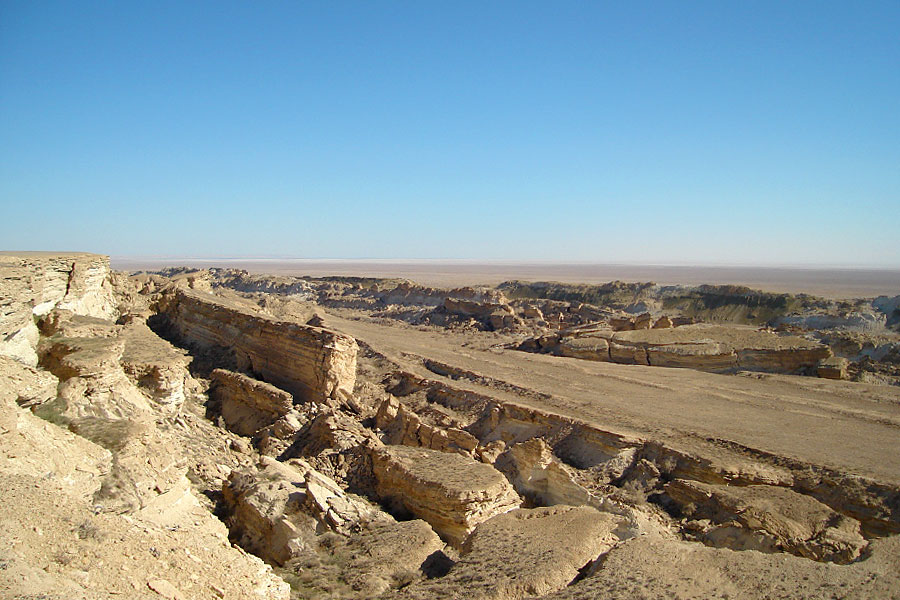
Traveling to the Ustyurt Plateau requires adherence to standard safety requirements for trips in wild desert territories. We do not recommend venturing to the Ustyurt Plateau or the Aral Sea on your own. The journey involves very steep ascents and descents, and vehicles can fall into voids from the burrows of desert rodents and other animals or get stuck in mud if you get too close to the current shore of the Aral Sea. Additionally, outdated GPS tracks for the Ustyurt trip found online may lead to now-destroyed roads and collapsed descents from the plateau. Therefore, it's best to rely on local drivers who are well acquainted with the Aralkum desert and all approaches to the Ustyurt Plateau, always prepared for any contingencies.
Also, it's important to avoid getting too close to the edge of the plateau's cliffs, as they are made of loose limestone and some edges are overhanging ledges.
Best Time to Visit the Ustyurt Plateau
The climate on the Ustyurt is desert-like and dry, with rare precipitation. Summers are long and very hot, often with daytime temperatures exceeding 40 degrees Celsius. Winters are cold with little snow, and due to winds on open spaces, very unpleasant. Therefore, the best time to visit the Ustyurt Plateau is April, May, September, and October.


